Where is Bangladesh Located?
Where is Bangladesh located on the map? Bangladesh is an independent nation located in Southern Asia. Check out the following images to see location of Bangladesh on maps.
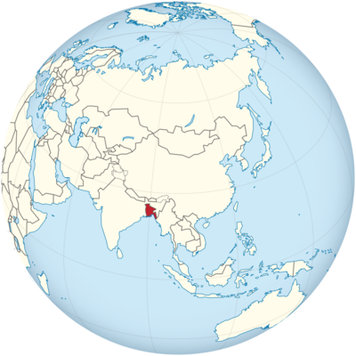
Bangladesh Location in World Map
On the map you can see the exact location of Bangladesh.
Location Information of Bangladesh
Latitude and Longitude
Bangladesh is located in South Asia, bordered by India to the west, north, and east, Myanmar to the southeast, and the Bay of Bengal to the south. The country is known for its vast river systems and its location in the low-lying delta. The geographical coordinates of Bangladesh are approximately:
- Latitude: 23.6850° N
- Longitude: 90.3563° E
These coordinates place Bangladesh in a region of high population density, and its location along the Bay of Bengal has made it both an important trade hub and a vulnerable area for natural disasters, particularly cyclones and flooding.
Capital City and Major Cities
- Capital City: DhakaDhaka is the capital and largest city of Bangladesh, located in the central part of the country, on the banks of the Buriganga River. With a population of over 21 million, Dhaka is one of the fastest-growing cities in the world. It is the political, economic, and cultural center of Bangladesh. Dhaka has a rich history, with landmarks such as the Lalbagh Fort, Ahsan Manzil, and the National Museum of Bangladesh. Despite its rapid urbanization, Dhaka faces challenges related to traffic congestion, air pollution, and inadequate infrastructure.
- Major Cities:
- Chittagong (Chattogram) – Located in the southeastern part of the country, Chittagong is the second-largest city in Bangladesh and the country’s main seaport. The city is known for its natural beauty, including Cox’s Bazar, the world’s longest natural sandy sea beach, and the Kaptai Lake.
- Khulna – Located in the southwestern part of Bangladesh, Khulna is an important industrial and commercial hub. It serves as the gateway to the Sundarbans, the largest mangrove forest in the world and a UNESCO World Heritage site, home to the Bengal tiger.
- Rajshahi – Situated in the northwest, Rajshahi is known as the silk capital of Bangladesh. It is a major cultural and educational center and is renowned for its mangoes and silk production.
- Sylhet – Located in the northeastern part of Bangladesh, Sylhet is known for its tea plantations and picturesque landscapes. The region is also significant due to its large expatriate population, particularly in the United Kingdom.
- Barisal – Known as the “Venice of the East,” Barisal is located in the south-central region of Bangladesh. The city is famous for its rivers, mangroves, and vibrant agricultural activities, particularly rice and fish farming.
Time Zone
Bangladesh operates in the Bangladesh Standard Time (BST) zone, which is UTC +6. The country does not observe daylight saving time, so the time remains consistent year-round. This time zone is shared with several countries in the region, including Bhutan and parts of Russia.
Climate
Bangladesh experiences a tropical monsoon climate, with three distinct seasons: summer (pre-monsoon), monsoon, and winter. Due to its low-lying geography and location on the Bay of Bengal, the country is highly susceptible to flooding, cyclones, and other weather-related events.
- Summer (Pre-Monsoon Season): The summer season lasts from March to May, with temperatures rising as high as 35°C (95°F) or more. This season is marked by high humidity and intense heat, especially in the southern and central regions of the country. Dust storms and heatwaves are common during this time.
- Monsoon Season: The monsoon season lasts from June to October, with the heaviest rainfall occurring between June and September. The monsoon winds bring copious amounts of rain, which can result in widespread flooding and landslides, especially in the low-lying areas. The temperature during this time generally ranges from 25°C to 30°C (77°F to 86°F).
- Winter Season: From November to February, Bangladesh experiences cooler temperatures and lower humidity. Winters are relatively mild, with temperatures ranging from 10°C to 20°C (50°F to 68°F). This is considered the most comfortable time of year to visit Bangladesh, as the weather is cooler and more pleasant.
Bangladesh is highly vulnerable to natural disasters, including tropical cyclones, which frequently affect the coastal areas. The combination of heavy monsoon rains, low-lying geography, and a dense population makes the country particularly susceptible to flooding.
Economic Status
Bangladesh has made significant strides in its economic development over the past few decades, driven by agriculture, manufacturing, and the services sector. Despite challenges such as poverty, infrastructure deficits, and political instability, Bangladesh has consistently posted high growth rates, particularly in sectors such as textiles and agriculture.
- Agriculture: Agriculture plays a crucial role in Bangladesh’s economy, with rice, jute, tea, and fish being the main agricultural products. The country is one of the largest producers of rice in the world. Bangladesh’s fertile lands and extensive river systems support agricultural activities, although challenges such as flooding and soil erosion affect output. The fishing industry is also significant, with both freshwater and marine resources contributing to exports.
- Textile and Garment Industry: The textile and garment industry is the backbone of Bangladesh’s economy. The country is the second-largest exporter of textiles and garments globally, behind China. Bangladesh’s low labor costs and growing export market have made it a dominant player in the global textile industry. The industry accounts for more than 80% of the country’s total exports, with major buyers in the United States, Europe, and other parts of Asia.
- Services Sector: The services sector in Bangladesh, including telecommunications, banking, and tourism, has seen rapid growth in recent years. The country’s banking sector has been expanding, and mobile banking has become a significant method of financial inclusion for the unbanked population. Bangladesh is also working to improve its infrastructure, including transportation networks, which will aid economic development.
- Manufacturing and Industry: Beyond textiles, Bangladesh’s manufacturing sector includes chemicals, pharmaceuticals, cement, and electronics. The government has made efforts to promote industrialization, with special economic zones set up for manufacturing and export. The Chittagong Port serves as a major trade hub, handling a significant portion of the country’s imports and exports.
- Challenges: Despite strong economic growth, Bangladesh faces several challenges, including poverty, income inequality, and environmental vulnerabilities due to climate change. Political instability and corruption continue to hinder further economic growth, as do inadequate infrastructure and a shortage of skilled labor in certain sectors. The country’s vulnerability to natural disasters, particularly floods and cyclones, poses significant risks to its agricultural and economic stability.
Tourist Attractions
Bangladesh is home to a rich cultural heritage, beautiful landscapes, and vibrant history. The country offers a variety of attractions for tourists, ranging from natural wonders to historical sites. Some of the most popular tourist destinations include:
- Sundarbans: The Sundarbans is the world’s largest mangrove forest and a UNESCO World Heritage site. It is home to the Bengal tiger, along with other wildlife such as crocodiles, spotted deer, and various species of birds. The Sundarbans offers a unique opportunity for eco-tourism and wildlife observation, with guided tours and boat safaris available.
- Cox’s Bazar: Located on the southeastern coast of Bangladesh, Cox’s Bazar is famous for having the longest natural sea beach in the world, stretching over 120 kilometers (75 miles). The beach is a popular tourist destination for both local and international visitors, offering swimming, surfing, and a wide range of beachside activities.
- Srimangal: Known as the “Tea Capital” of Bangladesh, Srimangal is located in the northeast and is famous for its tea gardens, rolling hills, and serene landscapes. Visitors can explore the lush green tea plantations, visit the Lawachara National Park, and enjoy the area’s tranquility.
- Paharpur: One of Bangladesh’s most significant archaeological sites, Paharpur is home to the Somapura Mahavihara, a large Buddhist monastic complex that dates back to the 8th century. It is a UNESCO World Heritage site and an important symbol of Bangladesh’s ancient history.
- Rangamati: Situated in the Chittagong Hill Tracts, Rangamati is known for its picturesque landscapes, including hills, forests, and lakes. The Kaptai Lake, surrounded by mountains, is a major attraction, and visitors can enjoy boating and trekking. The region is also home to various indigenous communities, offering a unique cultural experience.
- Madhabkunda Waterfall: Located in the Moulvibazar district, Madhabkunda is the largest waterfall in Bangladesh. The area is known for its natural beauty, with hiking trails, forests, and the waterfall providing an excellent spot for nature lovers and photographers.
- Historical Sites in Dhaka: Dhaka itself is rich in history, with several key landmarks such as the Lalbagh Fort, Ahsan Manzil, and Baitul Mukarram National Mosque. Visitors can also explore the National Museum and the Bangladesh Liberation War Museum, which provide insight into the country’s history and struggle for independence.
- Chittagong Hill Tracts: The hill tracts of Chittagong, located in the southeastern region, offer a unique cultural and natural experience. The area is home to several indigenous communities, including the Chakma, Marma, and Tripura people, and is known for its ethnic diversity, picturesque valleys, and waterfalls.
Visa Requirements for U.S. Citizens
U.S. citizens who wish to visit Bangladesh for tourism or business purposes must obtain a visa prior to arrival. The process involves the following:
- Visa Application: U.S. citizens must complete a visa application form, which can be obtained from the Bangladesh Embassy or Consulate. The application requires personal information, travel details, and supporting documents.
- Passport: A valid U.S. passport is required, with at least six months of validity remaining beyond the planned departure date from Bangladesh.
- Visa Fee: A visa fee is required, which may vary depending on the type of visa (tourist, business, etc.) and the duration of stay.
- Supporting Documents: U.S. citizens may need to provide documents such as hotel reservations, return or onward travel tickets, and financial statements showing proof of sufficient funds for their stay in Bangladesh.
For shorter stays (up to 30 days), U.S. citizens may be eligible for an e-visa, which can be applied for online. This option is available for tourist and business purposes and simplifies the visa process.
Distance to Major U.S. Cities
The approximate air distances from Dhaka to major U.S. cities are as follows:
- Distance to New York City: The distance from Dhaka to New York City is approximately 7,400 miles (11,900 kilometers). Flights typically take about 16-18 hours, with layovers in Middle Eastern or European cities such as Doha, Dubai, or Frankfurt.
- Distance to Los Angeles: The distance from Dhaka to Los Angeles is around 8,000 miles (12,875 kilometers). Flights usually take around 18-20 hours, depending on the route and layovers.
Bangladesh Facts
| Size | 147,570 km² |
| Residents | 158 million |
| Languages | Bengali and English |
| Capital | Dhaka |
| Longest river | Brahmaputra (2,900 km) |
| Highest mountain | Mowdok Mual (1,063 m) |
| Currency | Taka |


